tidy3d.plugins.invdes.FilterProject#
- class FilterProject[source]#
Bases:
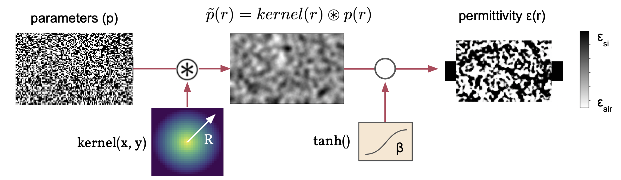
InvdesBaseModelTransformation involving convolution by a conic filter followed by a
tanhprojection.- Parameters:
radius (PositiveFloat) – [units = um]. Radius of the filter to convolve with supplied spatial data. Note: the corresponding feature size expressed in the device is typically sqrt(3) times smaller than the radius. For best results, it is recommended to make your radius about twice as large as the desired feature size. Note: the radius value is often only approximately related to the final feature sizes. It is useful to apply a
FilterProjecttransformation to ‘encourage’ larger feature sizes, but we ultimately recommend creating aErosionDilationPenaltyto theDesignRegion.penaltiesif you have strict fabrication constraints.beta (float = 1.0) – Steepness of the binarization, higher means more sharp transition at the expense of gradient accuracy and ease of optimization.
eta (float = 0.5) – Halfway point in projection function.
strict_binarize (bool = False) – If
False, the binarization is still continuous between min and max. IfTrue, the values are snapped to the min and max values after projection.
Notes
Attributes
Methods
evaluate(spatial_data, design_region_dl[, ...])Evaluate this transformation on spatial data, given the region grid size.
- radius#
- beta#
- eta#
- strict_binarize#